Click here to view image
Cartography
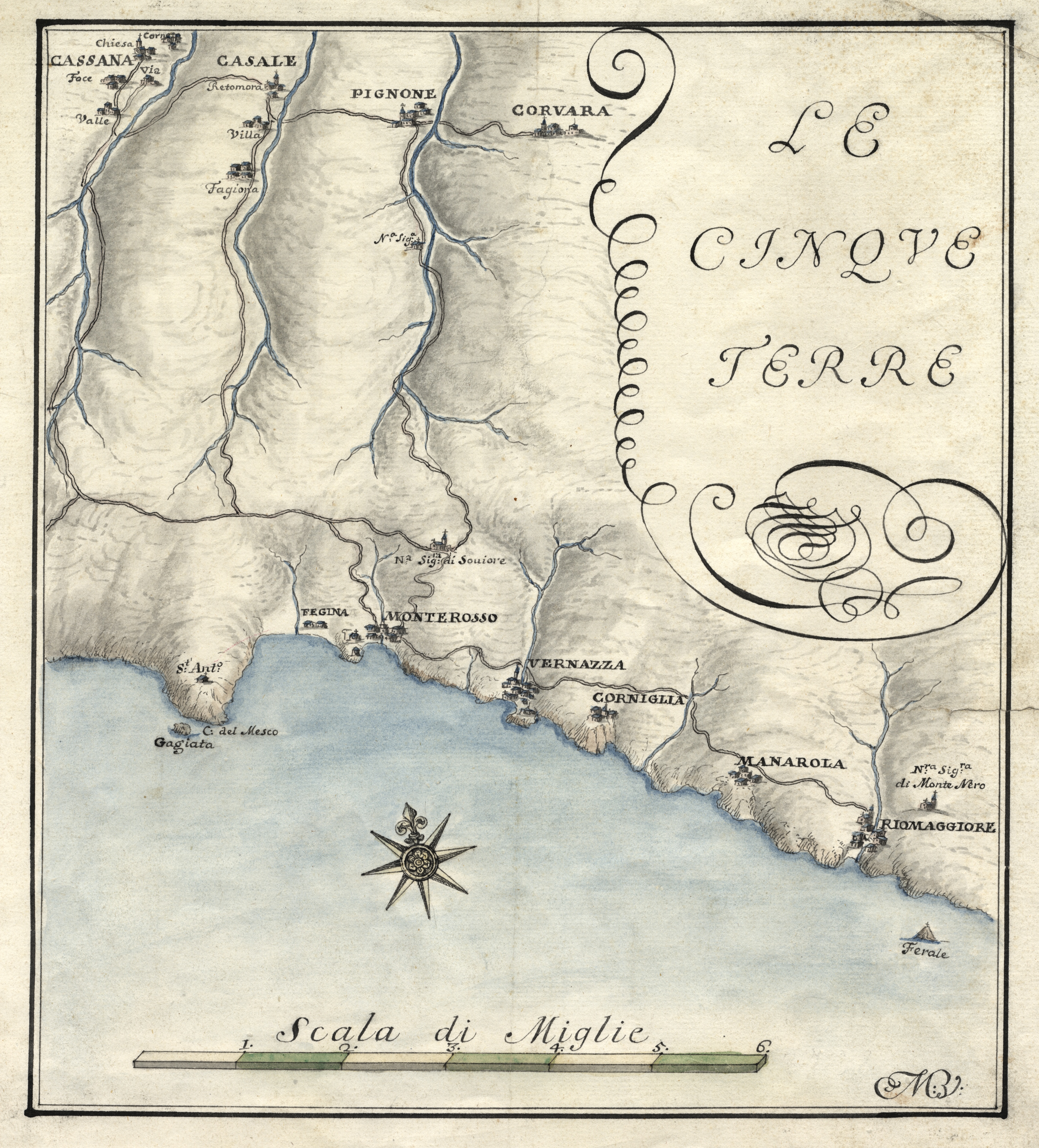
Drawing on paper with pencil and watercolor, mm 320x580
The most important cartographer in the service of the Republic of Genoa, Matteo Vinzoni (1690-1773), born in Montaretto near Bonassola, represents here, with essential and highly elegant features, the territory of “Cinque Terre” between Monterosso and Riomaggiore. The description of the territory, a central element for the political, military, economic and social activities of a state, is affirmed in Genoa quite late compared to other Italian realities, but experience a great development with the activity of Colonel Vinzoni, who takes care of the details of its representations through patrols on the territory, to have a first-hand knowledge of it. The current size of the cartographic collection is about 8788 units, between the first representations of the late fifteenth century and the end of the twentieth century. The collection can be consulted on the Topographia website:
http://www.topographia.it/DFrontofficeGe/index.htm;jsessionid=30B99F2DA1ABBAC5F516DFD40D15661E


